When it comes to land development, construction, or architectural design, the foundation of a successful project lies in accurate data. A Topographic survey in Melbourne is the essential first step for any landowner or developer looking to understand the unique characteristics of their terrain. By mapping both natural and man-made features, these surveys provide the clarity needed to turn a vision into a reality.
What is a Topographic Survey?
Often referred to as a contour or feature survey, a topographic survey identifies and maps the horizontal and vertical locations of objects on a piece of land. Unlike a standard boundary survey, which only shows property lines, a topographic survey details the “shape” of the land. This includes elevation changes, trees, existing buildings, utility points, and drainage patterns.
Why You Need a Topographic Survey in Melbourne
Melbourne’s diverse landscape—from the flat coastal plains to the undulating hills of the outer suburbs—requires specialized local knowledge. Developers and architects rely on these surveys for several critical reasons:
- Design Accuracy: Engineers use topographic data to ensure new structures sit correctly on the land, minimizing expensive excavation costs.
- Drainage and Grading: Understanding the slope of the land is vital for managing stormwater runoff and preventing future flooding issues.
- Council Approvals: Most local councils in Melbourne require a detailed feature survey before approving planning permits or building applications.
Modern Solutions with Scan Tech Surveys
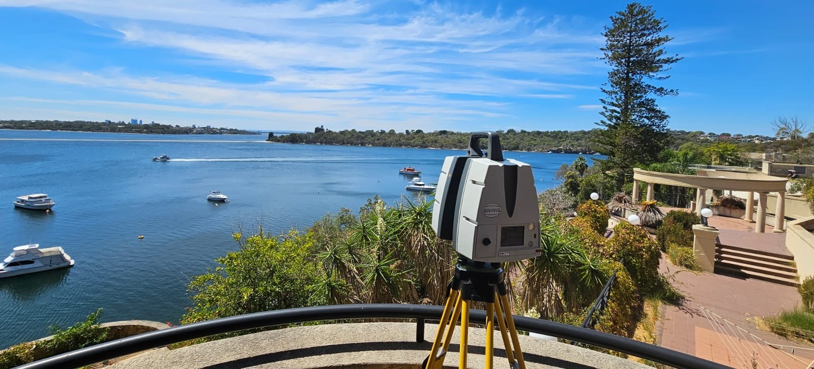
In the modern era, traditional surveying has evolved. At Scan Tech Surveys, we utilize advanced 3D Point Cloud technology to deliver unmatched precision. Whether you are working on a residential extension or a large-scale commercial development, our 3D scanning captures every detail of your site in high definition. This technology allows for the creation of highly accurate as-built architectural floor plans and elevation drawings, ensuring that your project starts with the best possible data.
Before you break ground, ensure your project is built on a foundation of accuracy.
Learn more about our services: https://www.scantechsurveys.com.au/


Leave a Reply